Hydrogeologist & Water Resources Specialist
Optimised for Desktop Viewing
J. Malcolm Ashworth is a freelance hydrogeologist and water resources specialist with more than 40 years of experience in groundwater and surface-water data analysis, mapping, modelling, assessment, and integrated water resources management. I provide independent, international expertise in understanding, quantifying, and resolving water resources and groundwater issues.
Guiding principles:
- Strive for excellence.
- Put the client's interests first.
- Tell the truth, even when it challenges the client's opinion.
- Only do work that I can do well.
- Only recommend work that is necessary to achieve the required results.
What I can offer you:
The following are some of the skills and services that I can offer you:
|
WATER RESOURCES
River Basin Assessment and Management: Setting aside the social, economic, legal, and political considerations, effective water resources management begins with a comprehensive assessment of a river basin’s water balance, available resources, and the ways in which changes to one component of the balance affect other components and the environment, in terms of quantity, quality, and location. Information compiled in databases and presented using ArcGIS maps provides an essential regional perspective for managing water resources. In general, four categories of data are required:
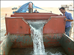
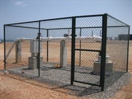
Expert services can be provided to collate and process water resources information from stakeholders, field inventories, pilot projects, and published and online sources, and to integrate these data into ArcGIS for assessment, management, reporting, and presentation. Exploration: Key datasets required for groundwater resource assessments are often missing or inadequate. In such cases, exploration boreholes, aquifer testing, and appropriate monitoring programmes may be required. Associated services include: facilitating remote-sensing investigations, including airborne, satellite and geophysical surveys; borehole design; preparation of tender documents and specifications; supervision of drilling and borehole construction; aquifer and borehole testing; and data analysis. Development: Effective groundwater management may require a range of different development options. Three common requirements are:
Consulting services can be provided for the design, tendering, supervision, testing, construction, and management of these and other groundwater development schemes. Evaluations: Technical advice can be provided to assess the effectiveness of groundwater assessment, management, and development programmes. Conflict Resolution: Technical advice can be provided to help understand and resolve water-resource conflicts. |
|
||||||||||||
|
GROUNDWATER MODELLING
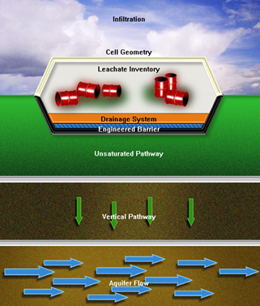
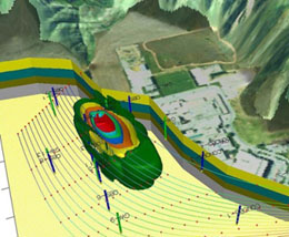
Groundwater models are valuable tools for analysing and predicting groundwater flow and contaminant transport in aquifers. Applications may include calculating the radius of influence of a well or wellfield, modelling the generation, movement, and attenuation of leachate, and assessing the impacts of large-scale groundwater abstraction on other users and available resources. Both analytical and numerical models can be used. The most appropriate approach depends on the complexity and objectives of the problem. Analytic Models Analytical models such as LANDSIM, CONSIM, GFLOW, and BLUEBIRD can be used to simulate steady-state, two-dimensional groundwater flow systems using analytical functions. These programmes use libraries of specialised analytical elements to represent features such as heads and flow rates, engineered barriers, advective transport, contaminant concentrations, drains, slurry walls, wells, and reservoirs. The functions associated with these elements satisfy Darcy’s law and mass-continuity requirements throughout the model domain. Some models, such as LANDSIM and CONSIM, are specifically designed to estimate potential contaminant concentrations using probabilistic assessment techniques. Numerical Models Numerical models such as the U.S. Geological Survey’s Modular Finite-Difference Flow Model (MODFLOW) provide numerical solutions for groundwater flow and contaminant transport problems in three dimensions. Since MODFLOW was first developed in 1983, numerous codes and packages have been developed to extend its capabilities. These include advective transport modelling (MODPATH), solute transport modelling (MT3D), parameter estimation and inverse modelling (PEST), solute transport modelling (MOC3D), and seawater intrusion modelling (SEAWAT). Commercial software such as the Groundwater Modelling System (GMS) integrates modelling packages with analysis, calibration, and 3-D visualisation tools in a single software environment. |
|
||||||||||||
|
ENVIRONMENTAL ASSESSMENT & COMPLIANCE WITH REMEDIAL TARGETS
Expert services can be provided to assist with Environmental Assessments and Remediation, including: Field Investigations, Laboratory Analyses and Monitoring: Sampling to identify and delineate sources of contamination; field investigations to characterise the extent of soil and groundwater contamination; laboratory testing to determine the properties of the soil, aquifer, and contaminants; and monitoring to assess whether contaminant concentrations meet acceptable levels. Soil and Groundwater Risk Assessments: Risk assessment of soil and groundwater contamination and vulnerability using a range of techniques, including UK Level 1–4 procedures, analytical and numerical groundwater models, and ArcGIS overlay and index methods, to support compliance with applicable environmental standards and regulatory requirements. |
|||||||||||||
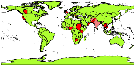
Countries of work-experience.